German Ridge is a recreational area and trail system in the southern reaches of the Hoosier National Forest. Prior to my visit I put forth a lot of research into the area and set my own expectation that it would be a treasure trove for waterfalls. Instead, it became a testament to the fact that locating waterfalls on maps can be deceiving.
What I found instead was a treasure trove for rock climbing potential, which wasn’t a bad trade I suppose. I was also able to verify that German Ridge is indeed a great location for backpacking. I decided to write this detailed trip report because there are no other good descriptions of the area available online and I hope to assist some folks with planning a backpacking trip of their own.
Words of caution
Hunting does take place on the trail system. Always wear hunter orange during hunting season.
Trails and tribulations
This hike is mostly on-trail with an overall mileage of about 16 miles. The total trail mileage available at German Ridge is 24 miles with several loops and trailheads that allow for variations in routes. Obstacles include the occasional downed tree and mud hole.
Trail quality is good; it is a mixture of hardpack dirt and gravel, as well as some gravel roads. The underbrush density off-trail is very low around rock outcrops but other areas have very thick underbrush especially where logging has taken place.
Area uses
Hiking, backpacking, rock climbing, bouldering, horseback riding, mountain biking, hunting
German Ridge Backpacking April 27th, 2019
My wife Stephanie and I set out early on Saturday morning to adventure on the German Ridge trail system for our third wedding anniversary. We planned to backpack the trail system for 2 days and take the opportunity to explore several off-trail locations along the way. We parked at the trailhead off Tree Farm Road and were immediately greeted by the sound of a gushing waterfall just a few feet down the trail. The falls at this location are formed in a layer of shale that drops about 10 feet into a shallow plunge pool. This waterfall has a large watershed compared to most other falls in the forest so it was running well at the time.
From Tree Farm road we hiked south toward the recreation area where we planned to have lunch at the lake and picnic tables. The mileage for this trail system is contradicted between different trail maps, but the posted map at the trailhead stated 2.8 miles from Tree Farm to the recreation area, which seemed about right. Along the way I had planned to find and document a couple of big waterfalls that I had spotted on the map, but both of them were a bust; they turned out to be nothing but a pile of rocks on the hillside. It was a disappointing discovery. On the bright side, the forest itself is very pretty and the trail conditions are pleasant as well. I’ve been disappointed with some of the other trails in the Hoosier National Forest that aren’t really trails at all, rather they are more like gravel roads that have been closed to automobile traffic. The German Ridge trail is mostly a packed dirt trail with all the feeling of a real outdoor adventure.
We reached the recreation area after a couple of hours of hiking. There is a nice wooden shelter and picnic area at the edge of the pond; a great place to stop for lunch while it rained.
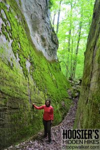
Just south of the pond is a little loop trail that passes by a long line of sandstone cliffs. These cliffs are not good for rock climbing but they are scenic and worth checking out. We hiked the loop and admired the mossy cliff-line for several hundred feet, but we decided to cut it short by ascending through a break in the cliffs that brought us up to the campground road. The campground at German Ridge Recreation Area has 20 sites with campfire rings, water access, and vault toilets. We decided to live a little more adventurously and opted not to camp there.
We continued our adventure on the southernmost trail marked on the map as 4.4 miles. It was a long walk through a pretty forest but lacked any other notable features.
We did encounter a formidable obstacle at East Deer Creek where there was deep water and no bridge. Crossing the creek involved some bushwhacking through a very dense and weeded forest to find a suitable path through the water. Our original plan was to cross the creek and veer off the main trail onto an old forest road leading to a cliff line. However, it turned out that the forest road was very overgrown due to a logging operation in the area so we continued further up the main trail to search for better access to the cliffs. I should also note that there was a campsite along the trail just north of the Deer Creek Crossing. Campsites are rare at German Ridge.
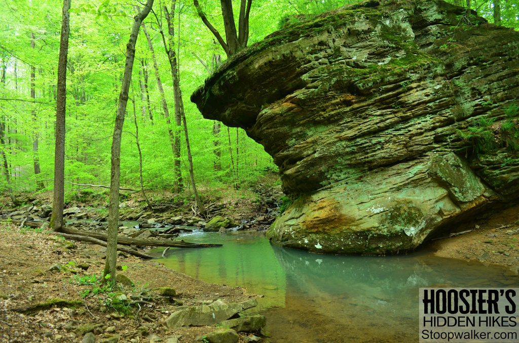
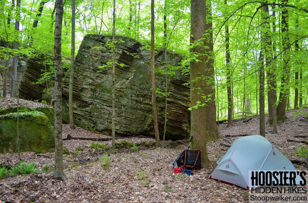
At a sharp switchback on the trail, we left the established path and headed directly east toward our destination. The forest was clear of underbrush and easy to travel. We passed over what I had hoped would be a nice waterfall but turned out to be another disappointing rock pile. Then right after that we rounded the corner and approached a grand scene that completely made up for the disappointment. Our destination turned out to be a very scenic sandstone gorge with massive boulders towering in the center of it all. By the side of the tiny stream is a campfire ring with enough space for a few small tents. We camped there that night and named the location Goosetown Gorge. The area doesn’t contain any significant waterfalls or rock shelters but it does have a scenic sandstone cliff-line with strong rock and excellent climbing potential.
The cliffs continue to wrap around the corner and run northeast for several hundred feet. Below the cliff line is a series of more giant boulders that were fun to hike around without our heavy packs.
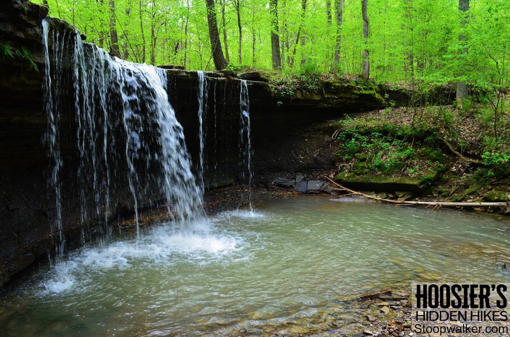
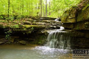
The next morning we hiked out of Goosetown Gorge back the way we came. There is a drizzling waterfall along the way that we stopped at to collect water for the day. I wouldn’t count on finding water there any time outside of the rainy spring season.
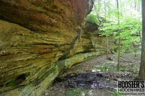
Back at the trail we headed north to continue our long hike out. At the Tower Rd trail intersection, we hung a left and hiked about 1,000 ft to our next off-trail destination, a rock outcrop known as the Helwig Hollow rock shelter. After hiking a short distance through the forest we encountered the edge of the cliff-line. Our excitement led us straight down into an interesting rock shelter that dipped under the wall like a bunker. A small waterfall was dripping water into the shelter creating a wet and muddy mess across the floor. The mud didn’t keep us out though; we walked straight into the dark void that rounded the corner beyond. The passage continued a short distance before encountering some boulders that we were able to squeeze through and get back to the surface.
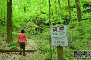
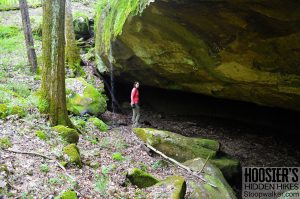
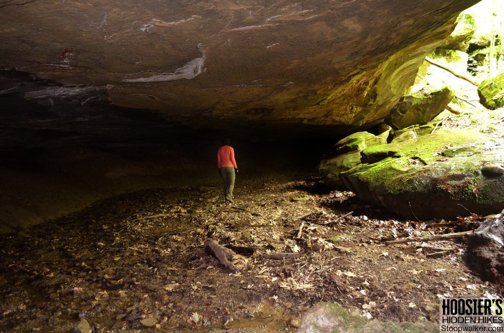
After exiting the rock shelter, we realized that there is a user-trail that provides easy access to the cliffs. There are also several signs marking the area as a protected archeological site. Several more rock overhangs and large boulders were found further down the cliff line as we thoroughly explored the area. This is a neat area that is worth visiting. I should note that the rock climbing potential is very poor at Helwig Hollow because it is very mossy and the rock just isn’t good for climbing. Stick to Goosetown Gorge if you are in the area to climb.
After thoroughly exploring Helwig Hollow we met back up with the main trail not too far away. I said farewell to the cliffs because I knew they would be the last ones we would get to see on this hike. At the bottom of the hill, we did have a surprise encounter with a beautiful stream and a massive house-sized boulder chilling out by the water. The shallow pool of water in the creek might even be a decent little wading pool in the summertime. This was also the location of a large camping area that would be suitable for group camping; the only large camp we encountered during the entire trip besides the official campground at the recreation area. I marked the location on my map as Boulder Camp.

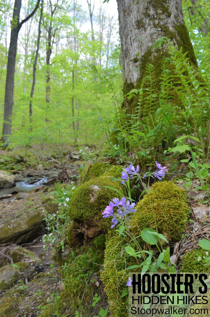
The rest of the backpacking trip was pretty ordinary. We crossed over a few nice little streams and saw a lot of wildflowers. There are many hills to climb up and down. The trail converted to a gravel road when we took the .4-mile connector trail, but it turned back into normal trail conditions soon enough.
Unfortunately, we had to skip the northernmost part of the trail for time’s sake. As we approached the end of our trip near the Tree Farm trailhead we did explore a couple more small waterfalls. The waterfall right next to the trail has a pretty cascade but is pretty mediocre compared to other waterfalls in the Hoosier National Forest.
Overall I would say that the trip was great despite a few problem areas. I recommend it as a spring season hike for the waterfall and wildflowers.