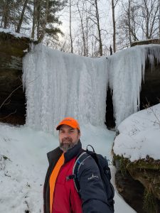
The Birdseye Trail has proven to be a convenient access route for an assortment of charming waterfalls. Located in Crawford County Indiana, the USFS describes it as an 11.6 mile multiple use trail for hiking, horse riding, and mountain biking. A small section of the trial is featured in the Hoosier’s Hidden Hikes guidebook, detailing two waterfalls aptly named Birdseye Falls 1 and 2. During the time I was doing research for the book, much of the trail system was closed for logging operations. Since reopening, I am happy to announce that I have documented eight more waterfalls along the trail system.
The trail quality varies between sections; most of it is in good condition with hard pack gravel, while some sections are grass covered and could be muddy in places. In late spring and summer, some sections can become overgrown with weeds and briars, especially the logged areas, which are very unpleasant to hike through. The logged areas are likely to be impassable off-trail.
The standout feature of this map is the highly detailed LiDar topography , which clearly shows all of the hills, valleys, streams, and even waterfalls. Of course all of the roads and trail sections are included, as are the waterfall locations. Look closely and you will notice the dotted zones, which indicate a logged forest area; these zones were identified via satellite imagery.
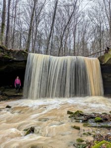
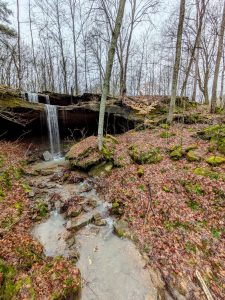
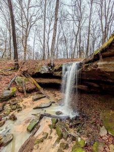
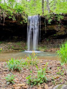
There are two parking areas worth noting because they circumvent the water crossings on Mitchell Creek. The parking area on Borden Rd provides access to a gravel road that leads to the lake. It can also be used to access Ferdinand Falls, but you will need to go around the logged area to reach it. The parking area on Potter Rd provides access to Potter Falls and Triple Pot Plunge. All of the waterfalls in this region are seasonal, meaning they only flow water in the Winter & Spring seasons when the ground is saturated.
Visit the download link below to obtain a high-resolution version of the map. Feel free to share it.